

Tracing the Evolution of GPS Technology: A Historical Overview
GPS, or Global Positioning System, is a technology that allows users to determine their precise location on Earth using signals from a network of satellites. It has become an integral part of modern society, with applications ranging from navigation and mapping to tracking and monitoring. GPS works by triangulating signals from multiple satellites to calculate the user’s position, velocity, and time. This information is then used to provide accurate location data.
The importance of GPS in modern society cannot be overstated. It has revolutionized the way we navigate and explore the world around us. Whether it’s finding the fastest route to a destination, tracking the location of a lost pet, or monitoring the movements of a fleet of vehicles, GPS has become an indispensable tool for individuals and businesses alike.
Key Takeaways
- GPS technology was first developed for military use, but has since become widely used in civilian applications.
- Satellite navigation systems like GPS have revolutionized the way we navigate and track objects.
- GPS technology has advanced significantly in the 21st century, with innovations like real-time tracking and improved accuracy.
- GPS is used in a variety of everyday applications, from navigation to tracking pets and children.
- GPS has had a major impact on transportation and logistics, making it easier to track shipments and optimize routes.
The Early Days of GPS: From Military to Civilian Use
The development of GPS can be traced back to the early days of the Cold War, when the United States military recognized the need for a reliable navigation system that could be used in any weather conditions and anywhere in the world. The first satellite in what would become the GPS constellation was launched in 1978, and by 1995, the system was declared fully operational.
Initially, GPS was primarily used for military purposes, such as guiding missiles and aircraft. However, as the technology became more advanced and affordable, it began to find its way into civilian applications. In the 1990s, GPS receivers started appearing in cars and handheld devices, making it easier for individuals to navigate unfamiliar places.
The Emergence of Satellite Navigation: GPS vs. Other Systems
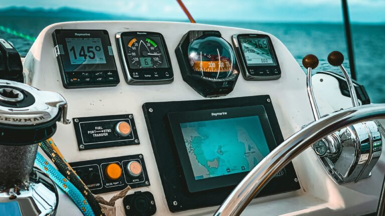
While GPS is the most well-known satellite navigation system, it is not the only one. There are several other systems that provide similar services, including GLONASS (Russia), Galileo (European Union), and BeiDou (China). Each system has its own advantages and disadvantages, and the choice of which system to use depends on factors such as accuracy requirements, availability of signals, and regional coverage.
GPS has several advantages over other satellite navigation systems. It has a larger number of satellites in orbit, which means that it can provide more accurate and reliable positioning information. GPS also has a larger market share and is supported by a wide range of devices and applications. However, GPS does have some limitations, such as reduced accuracy in urban canyons and indoor environments.
GPS Technology in the 21st Century: Advancements and Innovations
| Advancements and Innovations in GPS Technology in the 21st Century |
|---|
| Improved accuracy of GPS devices |
| Integration of GPS technology in smartphones and other mobile devices |
| Real-time tracking and monitoring of vehicles, assets, and people |
| Development of GPS-enabled wearables for fitness and health tracking |
| Use of GPS technology in precision agriculture for crop management and yield optimization |
| GPS technology in aviation for navigation and safety purposes |
| Integration of GPS technology in autonomous vehicles for navigation and control |
| Use of GPS technology in emergency response and disaster management |
| Development of GPS-enabled smart cities for efficient transportation and infrastructure management |
In recent years, GPS technology has seen significant advancements and innovations. One of the most notable developments is the introduction of augmented reality (AR) navigation systems, which overlay digital information onto the real world to provide users with a more immersive and intuitive navigation experience. Another advancement is the use of machine learning algorithms to improve the accuracy and reliability of GPS positioning.
Looking to the future, there are several exciting developments on the horizon for GPS technology. One area of focus is improving the accuracy of GPS in challenging environments, such as dense urban areas and indoor spaces. Another area of research is exploring ways to integrate GPS with other sensors and technologies, such as LiDAR and computer vision, to create more robust and versatile positioning systems.
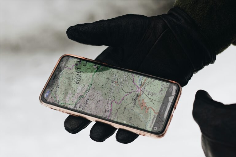
GPS Applications in Everyday Life: From Navigation to Tracking
GPS technology has become an integral part of everyday life for many people. One of the most common applications of GPS is navigation and mapping. Whether it’s finding the fastest route to a destination or exploring a new city, GPS provides users with accurate and up-to-date location information.
GPS is also widely used for tracking and monitoring purposes. For example, parents can use GPS-enabled devices to keep track of their children’s whereabouts, pet owners can use GPS trackers to locate lost pets, and businesses can use GPS to monitor the movements of their vehicles or assets.
The Role of GPS in Transportation and Logistics: Revolutionizing the Industry

GPS has had a profound impact on the transportation and logistics industry. It has revolutionized the way goods are transported and delivered, making the process more efficient and cost-effective. GPS allows companies to track the location of their vehicles in real-time, optimize routes to minimize fuel consumption and reduce delivery times, and provide customers with accurate and up-to-date information about the status of their shipments.
The benefits of GPS in transportation and logistics are numerous. It helps companies improve fleet management, reduce fuel costs, increase driver safety, and enhance customer satisfaction. GPS also enables companies to better respond to unexpected events, such as traffic congestion or vehicle breakdowns, by providing real-time information and alternative routes.
However, there are also challenges and limitations associated with GPS in transportation and logistics. For example, GPS signals can be affected by factors such as tall buildings, dense foliage, or adverse weather conditions, which can lead to inaccuracies in positioning data. There are also concerns about the security of GPS systems, as they can be vulnerable to hacking or spoofing attacks.
GPS and the Internet of Things (IoT): Integration and Interconnectivity
The Internet of Things (IoT) is a network of interconnected devices that can communicate with each other and exchange data. GPS plays a crucial role in the IoT by providing location information for connected devices. For example, a smart home system can use GPS to determine when a user is approaching their home and automatically adjust the temperature or turn on the lights.
GPS is integrated with other technologies in several ways. For example, GPS receivers can be combined with sensors such as accelerometers or gyroscopes to provide more accurate positioning data. GPS can also be integrated with wireless communication technologies such as Wi-Fi or cellular networks to enable real-time tracking and monitoring.
Looking ahead, there are many possibilities for the integration of GPS and IoT. For example, GPS can be used to track the location of assets or vehicles in real-time, monitor environmental conditions such as temperature or humidity, or enable location-based services such as personalized advertising or targeted promotions.
GPS and the Future of Autonomous Vehicles: Challenges and Opportunities
GPS plays a crucial role in the development and operation of autonomous vehicles. It provides the precise location data that is needed for navigation and control. Autonomous vehicles rely on GPS to determine their position on the road, plan routes, and avoid obstacles.
However, there are several challenges and opportunities associated with the use of GPS in autonomous vehicles. One challenge is the need for highly accurate and reliable positioning data, as even small errors can have significant consequences in a safety-critical application like autonomous driving. Another challenge is the need for real-time updates, as road conditions can change rapidly.
Despite these challenges, GPS presents many opportunities for the future of transportation. It can enable more efficient and safer transportation systems, reduce traffic congestion and emissions, and improve the overall user experience. GPS can also facilitate the integration of autonomous vehicles with other technologies, such as smart infrastructure or vehicle-to-vehicle communication.
GPS and Environmental Monitoring: A Powerful Tool for Research and Conservation
GPS technology has proven to be a powerful tool for environmental monitoring and research. It allows scientists to track the movements of animals, monitor changes in land cover or vegetation, and study the effects of climate change on ecosystems.
One of the key applications of GPS in environmental monitoring is wildlife tracking. By attaching GPS collars or tags to animals, researchers can collect data on their movements, behavior, and habitat use. This information is invaluable for understanding animal behavior, identifying critical habitats, and informing conservation efforts.
GPS is also used in land cover mapping and vegetation monitoring. By collecting GPS data along with other remote sensing data, such as satellite imagery or LiDAR data, researchers can create detailed maps of land cover types, monitor changes in vegetation over time, and assess the health of ecosystems.
The benefits of GPS in environmental monitoring are numerous. It allows researchers to collect large amounts of data over large spatial scales, which would be impossible to achieve using traditional field-based methods alone. GPS also provides a non-invasive way to study animals and ecosystems, as it does not require direct contact with the subjects.
The Social Impacts of GPS Technology: Privacy, Security, and Ethics
While GPS technology has brought many benefits to society, it also raises concerns about privacy, security, and ethics. One of the main privacy concerns with GPS is the potential for location tracking and surveillance. GPS-enabled devices can track the movements of individuals in real-time, which can be seen as a violation of privacy.
There are also security risks associated with GPS technology. For example, GPS signals can be jammed or spoofed, which can lead to inaccurate positioning data or even loss of control in safety-critical applications. There have been cases where criminals have used GPS jammers to disable tracking devices or interfere with navigation systems.
Ethical considerations also come into play when it comes to the use of GPS technology. For example, there are concerns about the ethical implications of using GPS to track employees or monitor their behavior. There are also questions about the fairness and equity of using GPS-based navigation systems, as they may favor certain groups or individuals over others.
In conclusion, GPS technology has become an integral part of modern society, with applications ranging from navigation and mapping to tracking and monitoring. It has revolutionized the way we navigate and explore the world around us and has had a profound impact on industries such as transportation, logistics, and environmental monitoring. While GPS brings many benefits, it also raises concerns about privacy, security, and ethics. As technology continues to advance, it is important to strike a balance between the benefits and risks associated with GPS technology.
If you’re interested in diving deeper into the fascinating history of GPS technology and its applications in sailing, you won’t want to miss “The Sailing GPS: Your Ultimate Resource for GPS Technology in Sailing.” This comprehensive article, available at https://thesailinggps.com/the-sailing-gps-your-ultimate-resource-for-gps-technology-in-sailing/, provides a wealth of information on how GPS has revolutionized the sailing world. From its inception to its current state, this resource covers everything you need to know about unlocking the full potential of GPS technology for your sailing adventures. Don’t forget to check out their blog section at https://thesailinggps.com/blog/ for more insightful articles on this topic.
FAQs
What is GPS?
GPS stands for Global Positioning System. It is a satellite-based navigation system that provides location and time information anywhere on or near the Earth’s surface.
When was GPS invented?
GPS was developed by the United States Department of Defense in the 1970s and became fully operational in 1995.
How does GPS work?
GPS works by using a network of satellites orbiting the Earth to transmit signals to GPS receivers on the ground. The receivers use these signals to calculate their precise location and provide navigation information.
What are the main uses of GPS?
GPS is used for a wide range of applications, including navigation, surveying, mapping, tracking, and timing. It is also used in many industries, such as aviation, transportation, and agriculture.
How accurate is GPS?
GPS is highly accurate, with most GPS receivers able to determine their location within a few meters. However, the accuracy can be affected by factors such as atmospheric conditions, signal interference, and the quality of the receiver.
What is the future of GPS?
The future of GPS is likely to involve continued improvements in accuracy and reliability, as well as the development of new applications and technologies. Some of the emerging trends in GPS include the use of augmented reality, autonomous vehicles, and the Internet of Things.


Leave feedback about this